Mount St. Helens
Jump to navigation
Jump to search
English: Mount St. Helens
日本語: セント・ヘレンズ山
Photos[edit]
Before 1980 eruption[edit]
-
Bulge on north side, 1 month before eruption
-
One day before 1980 eruption
-
landscape
-
Landscape Mode
1980 eruptions[edit]
-
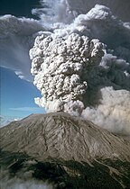
May 18, 1980 major eruption
-
May 18, 1980 major eruption
-
May 18, 1980 eruption was taken from 35 miles (60 km) west in Toledo, Washington.
-
Pyroclastic flow from May 1980 eruption
-
Car 10 miles away from eruption
-
July 22, 1980 eruption
-
Mount St Helens Erupting From Portland 1980
-
September 12 1980 Major Eruption
Post-1980 eruptions[edit]
-
1982 minor eruption
-
1999 minor eruption
-
2000 minor eruption
Post-1980 quiescence[edit]
-
The Sign Of Mount St. Helens In 1980
-
from Windy Ridge viewpoint, 1985
-
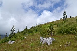
A forest of trees down, 23 years after the eruption
-
3-D perspective view from the northwest.
-
Mount St Helens from space, 2002
-
Lava dome in caldera
-
View from a commercial airliner, July 2007
-
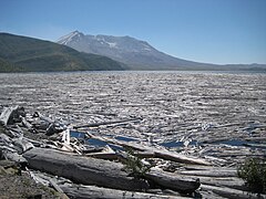
Logs adrift on Spirit Lake, 2012
-
Mount St. Helens East Flank
-
Waterfalls on the North Side Mount St. Helens
-
West Rim of the Cone
-
Mount St. Helens West Flank
-
Summit panorama
-
Lava dome panorama
-
Johnston Ridge
-
Wildflowers on Johnston Ridge
-
from Monitor Ridge
-
Today
-
Mount St. Helens in 2021
People[edit]
-
David Johnston
-
A hiker at the summit of Mount St. Helens, 1891
Maps and satellite images[edit]
-
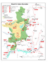
Mount St. Helens Recreation map
-
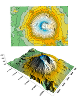
Contour and 3D map
-
elevation
-
elevation
-
elevation
-
Animated digital elevation map
-
South Washington Cascades topo map
-
Comparison between Mounts Rainier, Shasta, Adams, Hood, and St. Helens
-
Map of 1980 eruption deposits
-
Lava dome growth profile from 1980–1986
-
A view of the nearby area from space
-
April 30, 2015




.jpg/240px-Mount_St._Helens_(5046193029).jpg)


.jpg/271px-Whaleback%2C_Mount_St_Helens_volcanic_crater_(February_22_2005).jpg)





.jpg/155px-Mount_St._Helens%2C_Washington_(4599301444).jpg)


_cropped_2.JPG/252px-David_Johnston_near_crest_of_the_bulge_on_the_north_side_of_Mount_St._Helens%2C_17_May_1980_(USGS)_cropped_2.JPG)

.png/376px-3_Arc_Second_(4).png)
.png/371px-9_Arc_Second_(2).png)


