Category:1876 maps
Jump to navigation
Jump to search
| ← · 1870 · 1871 · 1872 · 1873 · 1874 · 1875 · 1876 · 1877 · 1878 · 1879 · → |
Deutsch: Karten mit Bezug zum Jahr 1876
English: Maps related to the year 1876
Español: Mapas relativos al año 1876
Français : Cartes concernant l’an 1876
Русский: Карты 1876 года
Subcategories
This category has the following 10 subcategories, out of 10 total.
*
- 1876 maps of the world (9 F)
A
E
G
N
S
- 1876 maps of South America (9 F)
T
- The Collegiate Atlas (1876) (50 F)
U
- 1876 maps of Ukraine (1 F)
Media in category "1876 maps"
The following 200 files are in this category, out of 348 total.
(previous page) (next page)-
Map of British Guiana (1876).jpg 3,101 × 4,298; 6.31 MB
-
COX(1876) p008 GREEK AND PHENICIAN SETTLEMENTS.jpg 3,201 × 1,851; 2.37 MB
-
COX(1876) p139 GREEK SETTLEMENTS IN ASIA MINOR.jpg 1,185 × 2,045; 1.39 MB
-
COX(1876) p219 THERMOPYLAI.jpg 2,043 × 1,247; 1.31 MB
-
COX(1876) p241 BATTLE OF SALAMIS.jpg 1,421 × 1,265; 930 KB
-
COX(1876) p262 BATTLE OF PLATAIAI.jpg 1,419 × 1,231; 914 KB
-
COX(1876) p303 ATHENS AND ITS NEIGHBOURHOOD.jpg 2,052 × 1,277; 1.37 MB
-
COX(1876) p363 PLAN OF THE HARBOUR OF NAVARINO.jpg 1,243 × 2,079; 1.25 MB
-
COX(1876) p432 SYRACUSE (1).jpg 2,051 × 1,243; 1.26 MB
-
COX(1876) p441 SYRACUSE (3).jpg 2,120 × 1,270; 1.41 MB
-
COX(1876) p453 SYRACUSE (2).jpg 2,025 × 1,261; 1.19 MB
-
COX(1876) p689 THE CAMPAIGNS OF ALEXANDER.jpg 2,019 × 1,219; 1.26 MB
-
(1876) Notizie storiche di Pola p465.jpg 1,889 × 1,858; 2.55 MB
-
(1876) Notizie storiche di Pola p471.jpg 3,289 × 4,194; 5.83 MB
-
1876 B&O.jpg 6,279 × 4,359; 5.79 MB
-
1876 Boston and Mystic Valley Railroad map.jpg 10,032 × 4,024; 10.94 MB
-
1876 French celestial map game board - Jeu des constellations ou voyage dans les regions celestes.jpg 15,251 × 11,968; 31.45 MB
-
1876 Stieler's Map of Southeastern Australia - Geographicus - AustraliaEast-s-76.jpg 3,389 × 4,000; 3.87 MB
-
1876年大日本全図.jpg 500 × 333; 35 KB
-
Africaitsinhabit02recl 0022.jpg 1,913 × 3,084; 377 KB
-
Africaitsinhabit02recl 0029.jpg 1,913 × 3,084; 580 KB
-
Africaitsinhabit02recl 0040.jpg 1,913 × 3,084; 519 KB
-
Africaitsinhabit02recl 0050.jpg 1,913 × 3,084; 503 KB
-
Africaitsinhabit02recl 0051.jpg 1,913 × 3,084; 649 KB
-
Africaitsinhabit02recl 0052.jpg 1,913 × 3,084; 588 KB
-
Africaitsinhabit02recl 0056.jpg 1,913 × 3,084; 534 KB
-
Africaitsinhabit02recl 0057.jpg 1,913 × 3,084; 555 KB
-
Africaitsinhabit02recl 0060.jpg 1,913 × 3,084; 682 KB
-
Africaitsinhabit02recl 0065.jpg 1,913 × 3,084; 521 KB
-
Africaitsinhabit02recl 0066.jpg 1,913 × 3,084; 563 KB
-
Africaitsinhabit02recl 0075.jpg 1,913 × 3,084; 674 KB
-
Agricultural Productions in the United States. NYPL1584684.tiff 5,428 × 6,720; 104.36 MB
-
Alaska; United States of America NYPL1584678.tiff 5,428 × 6,720; 104.36 MB
-
American bisons, living and extinct BHL12515539.jpg 9,074 × 7,990; 6.36 MB
-
Annandale (Village); Red Hook (Village); Cedar Hill (Village) NYPL1584622.tiff 5,428 × 6,720; 104.36 MB
-
Aqueduc de Fréjus Galerie Romaine des Vaux plans.jpg 2,000 × 1,166; 1.02 MB
-
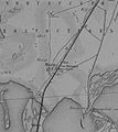
Aqueduc de Fréjus schéma de Dabadie Chem.Fer (1876) AD-83 7 S, Art 77-3.jpg 1,692 × 1,440; 810 KB
-
Aquitania Longnon 806.jpg 2,313 × 2,653; 2.9 MB
-
Ataman 1876 Map.jpg 393 × 442; 46 KB
-
August Heinrich Petermann, Klein Asien & Syrien (FL13728993 2514525).jpg 7,661 × 6,303; 72.96 MB
-
August Heinrich Petermann, Palaestina im Maassstabe (FL199420713 2368868).jpg 7,335 × 5,951; 25.95 MB
-
Bangor (Township); West Bangor (Village) NYPL1584450.tiff 5,428 × 6,550; 101.72 MB
-
Battle of Big Black River Bridge map.jpg 1,600 × 1,527; 642 KB
-
Beekman (Township) NYPL1584647.tiff 6,720 × 5,428; 104.36 MB
-
Bird's eye view of the city of Portland, Maine 1876. LOC 75693248.jpg 10,448 × 6,912; 14.9 MB
-
Bird's eye view of the city of Portland, Maine 1876. LOC 75693248.tif 10,448 × 6,912; 206.61 MB
-
Bird's eye view of Walla Walla, Washington Territory 1876. LOC 75696671.jpg 8,936 × 5,784; 11.64 MB
-
Bird's eye view of Walla Walla, Washington Territory 1876. LOC 75696671.tif 8,936 × 5,784; 147.87 MB
-
Birds eye view of Jacksonville, Fla. LOC 75693180.jpg 9,920 × 7,872; 12.85 MB
-
Birds eye view of Jacksonville, Fla. LOC 75693180.tif 9,920 × 7,872; 223.42 MB
-
Birmingham, Conn. 1876. LOC 74693153.jpg 7,808 × 6,496; 9.05 MB
-
Boome County Agricultural Society. NYPL1575973.tiff 6,966 × 5,428; 108.18 MB
-
BrunswickDistrict6Map.jpg 1,515 × 1,375; 1.97 MB
-
Bulletin monumental Tumulus Crugon.jpg 897 × 566; 209 KB
-
Business Directory. NYPL1581187.tiff 5,316 × 6,334; 96.34 MB
-
Business Directory. NYPL1581188.tiff 5,364 × 6,498; 99.72 MB
-
Business Directory. NYPL1581189.tiff 5,316 × 6,392; 97.22 MB
-
Business Notices. (cont.) NYPL1575933.tiff 5,428 × 7,230; 112.28 MB
-
Business Notices. NYPL1575932.tiff 5,428 × 7,230; 112.28 MB
-
Business Notices. NYPL1584464.tiff 5,428 × 6,550; 101.72 MB
-
Carl Zimmermann, Durchschnitts-Profile zu den Terrainkarten I U. II (FL164011347 2368221).jpg 15,316 × 11,925; 169.33 MB
-
Carl Zimmermann, Terrainkarte von Jerusalem und Umgebung vor der Besiedelung (FL51415413 2761974).jpg 11,764 × 15,347; 267.35 MB
-
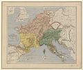
Carte de l'empire de Charlemagne après le partage de 806.jpg 7,293 × 6,141; 9.88 MB
-
Carthage Landing (Village); Hughsonville (Village); Fishkill P.O. (Village) NYPL1584644.tiff 5,428 × 6,720; 104.36 MB
-
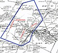
Centennial Map of Monsey (1876).jpg 600 × 589; 112 KB
-
Chateaugay (Township) NYPL1584455.tiff 5,428 × 6,550; 101.72 MB
-
City of Norwich, Conn. (2673808765).jpg 10,392 × 6,976; 59.81 MB
-
Clinton (Township) NYPL1584630.tiff 5,428 × 6,720; 104.36 MB
-
Colton's map of the State of Tennessee. LOC 78693125.tif 15,703 × 6,942; 311.88 MB
-
Colton's Palestine (FL37821529 3923184).jpg 8,989 × 10,820; 141.05 MB
-
Constable Business Notices.; Constable (Township) NYPL1584457.tiff 5,428 × 6,550; 101.72 MB
-
Deposit, Sanford TP (Village) NYPL1576046.tiff 6,998 × 5,428; 108.68 MB
-
Die Gartenlaube (1876) b 267 1.jpg 1,578 × 1,606; 1.72 MB
-
Dresden1876.png 1,170 × 878; 862 KB
-
Eastern Hemisphere NYPL1584662.tiff 5,428 × 6,720; 104.36 MB
-
Edward Colleman, Carte de Jérusalem d'apres Monsieur de Saulcy 1875 (FL45584518 3926852).jpg 2,668 × 2,089; 1.14 MB
-
Eugène Andriveau-Goujon, Palestine ancienne & moderne (FL35080981 3888672).jpg 12,499 × 16,571; 309.91 MB
-
Europe NYPL1584672.tiff 6,720 × 5,428; 104.36 MB
-
Fly River 1876.tif 1,742 × 1,435; 7.18 MB
-
Fly River Map 1876 NLA.jpg 1,950 × 1,300; 475 KB
-
General Description - Asia, Africa, and Oceanica. NYPL1584674.tiff 5,428 × 6,720; 104.36 MB
-
General Description - Europe. NYPL1584671.tiff 5,428 × 6,720; 104.36 MB
-
General Description - North America. (cont.) NYPL1584665.tiff 5,428 × 6,720; 104.36 MB
-
General Description - North America. NYPL1584664.tiff 5,428 × 6,720; 104.36 MB
-
General Description - South America. NYPL1584668.tiff 5,428 × 6,720; 104.36 MB
-
General Karte von Bosnien, der Hercegovina, von Serbien und Montenegro 01 (FL37099094 2525779).jpg 12,649 × 10,989; 225.91 MB
-
General Karte von Bosnien, der Hercegovina, von Serbien und Montenegro 02 (FL37099095 2525779).jpg 12,609 × 11,067; 224.4 MB
-
General Karte von Bosnien, der Hercegovina, von Serbien und Montenegro 03 (FL37099096 2525779).jpg 12,472 × 10,936; 209.07 MB
-
General Karte von Bosnien, der Hercegovina, von Serbien und Montenegro 04 (FL37099097 2525779).jpg 12,608 × 11,092; 215.55 MB
-
General Karte von Bosnien, der Hercegovina, von Serbien und Montenegro 05 (FL37099098 2525779).jpg 12,638 × 11,001; 225.97 MB
-
General Karte von Bosnien, der Hercegovina, von Serbien und Montenegro 06 (FL37099099 2525779).jpg 12,590 × 11,007; 216.45 MB
-
General Karte von Bosnien, der Hercegovina, von Serbien und Montenegro 07 (FL37099100 2525779).jpg 12,689 × 10,994; 229.25 MB
-
General Karte von Bosnien, der Hercegovina, von Serbien und Montenegro 08 (FL37099101 2525779).jpg 12,553 × 11,075; 218.26 MB
-
General Karte von Bosnien, der Hercegovina, von Serbien und Montenegro 09-title (FL37099102 2525779).jpg 12,489 × 10,875; 197.35 MB
-
General Karte von Bosnien, der Hercegovina, von Serbien und Montenegro 10 (FL37099103 2525779).jpg 12,608 × 11,129; 200.13 MB
-
General Karte von Bosnien, der Hercegovina, von Serbien und Montenegro 11 (FL37099104 2525779).jpg 12,417 × 10,861; 227.36 MB
-
General Karte von Bosnien, der Hercegovina, von Serbien und Montenegro 12 (FL37099105 2525779).jpg 12,529 × 10,855; 225.95 MB
-
Geologische Karte der Insel Sylt 1876 Ludwig Meyn-2.jpg 10,813 × 12,732; 96.06 MB
-
Geologische Karte der Insel Sylt 1876 Ludwig Meyn.jpg 7,645 × 9,002; 11.07 MB
-
Geologische Karte der Insel Sylt 1876 Ludwig Meyn.tif 7,645 × 9,002; 393.86 MB
-
Gray's Geological Map of the United States NYPL1584685.tiff 7,230 × 5,428; 112.31 MB
-
Heinrich Kiepert, Environs of Jerusalem (FL45601927 3934147).jpg 2,589 × 2,003; 1.83 MB
-
Heinrich Kiepert, General plan of Jerusalem 01 (FL173354590 0991263).jpg 3,784 × 2,899; 9.88 MB
-
Heinrich Kiepert, General plan of Jerusalem 02 (FL173354591 0991263).jpg 3,578 × 2,900; 8.26 MB
-
Heinrich Kiepert, Judæa (FL45601932 3934139).jpg 2,900 × 1,871; 1.71 MB
-
Holyoke1876 MBradley.png 2,424 × 1,605; 5.23 MB
-
Index. NYPL1584444.tiff 5,428 × 6,550; 101.72 MB
-
Indexed map of Arizona showing the stage lines, counties, lakes & rivers. LOC 98688443.tif 3,912 × 6,024; 67.42 MB
-
Irondale (Village); Millerton (Village); North East (Township) NYPL1584632.tiff 5,428 × 6,720; 104.36 MB
-
Johnsville (Village); East Fishkill (Township) NYPL1584654.tiff 5,428 × 6,720; 104.36 MB
-
TK25 Sachsen Äquidistantenkarte Montage Leipziger Gewässerknoten und Elsteraue 1880.jpg 7,440 × 10,680; 25.86 MB
-
Maastricht, kavels Herbenusstraat-Statensingel (detail).jpg 1,742 × 1,257; 1.05 MB
-
Maastricht, kavels Herbenusstraat-Statensingel.jpg 1,679 × 408; 324 KB
-
Manchester, N.H. (2675006263).jpg 2,000 × 1,351; 2.93 MB
-
Map of Barker Township NYPL1576011.tiff 5,428 × 6,982; 108.43 MB
-
Map of Bedford Township, Michigan, 1876.jpg 7,578 × 9,168; 10.64 MB
-
Map of Binghamton Township NYPL1576026.tiff 7,230 × 5,072; 104.92 MB
-
Map of Boyle & Mercer counties, Kentucky LOC 2012593101.jpg 12,719 × 15,135; 23.64 MB
-
Map of Boyle & Mercer counties, Kentucky LOC 2012593101.tif 12,719 × 15,135; 550.75 MB
-
Map of Chenango Township, Map of Fenton Township NYPL1576035.tiff 7,230 × 5,072; 104.92 MB
-
Map of Fauquier County, Virginia. LOC 73696164.jpg 7,051 × 9,649; 6.35 MB
-
Map of Fauquier County, Virginia. LOC 73696164.tif 7,051 × 9,649; 194.65 MB
-
Map of Juneau County, Wisconsin LOC 2012593198.jpg 12,861 × 19,892; 37.67 MB
-
Map of Juneau County, Wisconsin LOC 2012593198.tif 12,861 × 19,892; 731.94 MB
-
Map of Lisle Township; Killawog (Village) NYPL1576007.tiff 5,428 × 6,982; 108.43 MB
-
Map of Little North Mt. land (collat to SGC 20m Ap. 1, 1879) LOC 2005625149.jpg 3,636 × 3,322; 1.6 MB
-
Map of Little North Mt. land (collat to SGC 20m Ap. 1, 1879) LOC 2005625149.tif 3,636 × 3,322; 34.56 MB
-
Map of Maine Township NYPL1576013.tiff 6,982 × 5,428; 108.43 MB
-
Map of Nanticoke Township; Glen Aubrey(Village) NYPL1576009.tiff 6,982 × 5,428; 108.43 MB
-
Map of Pine Plains Township.; Pine Plains (Village); Rock City (Village) NYPL1584629.tiff 10,328 × 7,760, 2 pages; 229.56 MB
-
Map of Pleasant Valley Dutchess County. (Township) NYPL1584633.tiff 4,020 × 2,700; 31.06 MB
-
Map of Rossville and Southern Extention of Binghampton (sic) NYPL1575989.tiff 4,533 × 3,913; 50.75 MB
-
Map of Sanford Township; Gulf Summit, Sanford TP (Village) NYPL1576044.tiff 5,072 × 7,230; 104.92 MB
-
Map of the battle field of Gettysburg. July 1st, 2nd, 3rd, 1863 LOC lva0000067.jpg 9,527 × 12,001; 20.82 MB
-
Map of the battle field of Gettysburg. July 1st, 2nd, 3rd, 1863 LOC lva0000067.tif 9,527 × 12,001; 327.11 MB
-
Map of the cities of Washington and Georgetown D.C. LOC 87694046.tif 6,529 × 5,129; 95.81 MB
-
Map of the island of Ascension Wellcome L0051078.jpg 6,266 × 4,836; 7.23 MB
-
Map of the village of Jamaica, Queens County, N.Y. - showing every lot and building. LOC 2003630661.tif 10,196 × 8,052; 234.89 MB
-
MAPPA- Syracuse - Athenian expedition.jpg 640 × 386; 76 KB
-
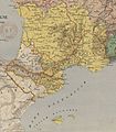
Marca Hispanica Longnon 806.png 1,448 × 1,404; 3.8 MB
.jpg/86px-Map_of_British_Guiana_(1876).jpg)
_p008_GREEK_AND_PHENICIAN_SETTLEMENTS.jpg/120px-COX(1876)_p008_GREEK_AND_PHENICIAN_SETTLEMENTS.jpg)
_p139_GREEK_SETTLEMENTS_IN_ASIA_MINOR.jpg/69px-COX(1876)_p139_GREEK_SETTLEMENTS_IN_ASIA_MINOR.jpg)
_p219_THERMOPYLAI.jpg/120px-COX(1876)_p219_THERMOPYLAI.jpg)
_p241_BATTLE_OF_SALAMIS.jpg/120px-COX(1876)_p241_BATTLE_OF_SALAMIS.jpg)
_p262_BATTLE_OF_PLATAIAI.jpg/120px-COX(1876)_p262_BATTLE_OF_PLATAIAI.jpg)
_p303_ATHENS_AND_ITS_NEIGHBOURHOOD.jpg/120px-COX(1876)_p303_ATHENS_AND_ITS_NEIGHBOURHOOD.jpg)
_p363_PLAN_OF_THE_HARBOUR_OF_NAVARINO.jpg/72px-COX(1876)_p363_PLAN_OF_THE_HARBOUR_OF_NAVARINO.jpg)
_p432_SYRACUSE_(1).jpg/120px-COX(1876)_p432_SYRACUSE_(1).jpg)
_p441_SYRACUSE_(3).jpg/120px-COX(1876)_p441_SYRACUSE_(3).jpg)
_p453_SYRACUSE_(2).jpg/120px-COX(1876)_p453_SYRACUSE_(2).jpg)
_p689_THE_CAMPAIGNS_OF_ALEXANDER.jpg/120px-COX(1876)_p689_THE_CAMPAIGNS_OF_ALEXANDER.jpg)
_Notizie_storiche_di_Pola_p465.jpg/120px-(1876)_Notizie_storiche_di_Pola_p465.jpg)
_Notizie_storiche_di_Pola_p471.jpg/94px-(1876)_Notizie_storiche_di_Pola_p471.jpg)


%2C_China_-_Geographicus_-_Taiwan-imray-1876.jpg/120px-1876_Imray_Blue-back_Nautical_Chart_or_Map_of_Taiwan_(Formosa)%2C_China_-_Geographicus_-_Taiwan-imray-1876.jpg)


.jpg/120px-A_plan_of_the_property_of_the_Hampton_Normal_and_Agricultural_Institute_at_Hampton_Virginia_(5960819963).jpg)


%3B_Clinton_Corners_(Village)%3B_Sharon_Station_(Village)%3B_Map_of_Amenia_Township._NYPL1584638.tiff/lossy-page1-120px-Amenia_Union_(Village)%3B_Clinton_Corners_(Village)%3B_Sharon_Station_(Village)%3B_Map_of_Amenia_Township._NYPL1584638.tiff.jpg)

%3B_Red_Hook_(Village)%3B_Cedar_Hill_(Village)_NYPL1584622.tiff/lossy-page1-97px-Annandale_(Village)%3B_Red_Hook_(Village)%3B_Cedar_Hill_(Village)_NYPL1584622.tiff.jpg)

_AD-83_7_S%2C_Art_77-3.jpg/120px-Aqueduc_de_Fréjus_schéma_de_Dabadie_Chem.Fer_(1876)_AD-83_7_S%2C_Art_77-3.jpg)
.jpg/120px-August_Heinrich_Petermann%2C_Klein_Asien_%26_Syrien_(FL13728993_2514525).jpg)
.jpg/120px-August_Heinrich_Petermann%2C_Palaestina_im_Maassstabe_(FL199420713_2368868).jpg)
%3B_West_Bangor_(Village)_NYPL1584450.tiff/lossy-page1-99px-Bangor_(Township)%3B_West_Bangor_(Village)_NYPL1584450.tiff.jpg)
%3B_Bagor_Business_Notices.%3B_Town_of_Bugar_Business_Directory%3B_Bellmont_Business_Notices.%3B_North_Bangor_(Village)%3B_Bellmont_(Township)_NYPL1584451.tiff/lossy-page1-86px-thumbnail.tiff.jpg)


_NYPL1584647.tiff/lossy-page1-120px-Beekman_(Township)_NYPL1584647.tiff.jpg)
%3B_City_(Village)%3B_Green_Haven_(Village)%3B_Pouquag_(Village)%3B_New_Hamburg_(Village)_NYPL1584649.tiff/lossy-page1-97px-Beekmanville_(Village)%3B_City_(Village)%3B_Green_Haven_(Village)%3B_Pouquag_(Village)%3B_New_Hamburg_(Village)_NYPL1584649.tiff.jpg)


%3B_Goodwins_Mill_(Village)%3B_Brainardville_(Village)%3B_Popeville_(Village)%3B_Bombay_Business_Notices.%3B_Brainardville_Business_Notices.%3B_Bombay_(Township)_NYPL1584452.tiff/lossy-page1-120px-thumbnail.tiff.jpg)



_NYPL1575933.tiff/lossy-page1-90px-Business_Notices._(cont.)_NYPL1575933.tiff.jpg)


_LOC_99447172.jpg/120px-Campaign_map_of_Texas%2C_Louisiana_and_Arkansas%2C_showing_all_the_battle_fields_and_also_the_marches_of_Walker%27s_Division._(1861-65)_LOC_99447172.jpg)
_LOC_99447172.tif/lossy-page1-120px-Campaign_map_of_Texas%2C_Louisiana_and_Arkansas%2C_showing_all_the_battle_fields_and_also_the_marches_of_Walker%27s_Division._(1861-65)_LOC_99447172.tif.jpg)
.jpg/120px-Carl_Zimmermann%2C_Durchschnitts-Profile_zu_den_Terrainkarten_I_U._II_(FL164011347_2368221).jpg)
.jpg/94px-Carl_Zimmermann%2C_Terrainkarte_des_heutigen_Jerusalem_und_Umgebung_(FL6878720_2368222).jpg)
.jpg/92px-Carl_Zimmermann%2C_Terrainkarte_von_Jerusalem_und_Umgebung_vor_der_Besiedelung_(FL51415413_2761974).jpg)
%3B_Hughsonville_(Village)%3B_Fishkill_P.O._(Village)_NYPL1584644.tiff/lossy-page1-97px-Carthage_Landing_(Village)%3B_Hughsonville_(Village)%3B_Fishkill_P.O._(Village)_NYPL1584644.tiff.jpg)
.jpg/120px-Centennial_Map_of_Monsey_(1876).jpg)
_NYPL1584455.tiff/lossy-page1-99px-Chateaugay_(Township)_NYPL1584455.tiff.jpg)
.jpg/120px-City_of_Norwich%2C_Conn._(2673808765).jpg)
_NYPL1584630.tiff/lossy-page1-97px-Clinton_(Township)_NYPL1584630.tiff.jpg)


.jpg/100px-Colton%27s_Palestine_(FL37821529_3923184).jpg)
_NYPL1584457.tiff/lossy-page1-99px-Constable_Business_Notices.%3B_Constable_(Township)_NYPL1584457.tiff.jpg)

_NYPL1576046.tiff/lossy-page1-120px-Deposit%2C_Sanford_TP_(Village)_NYPL1576046.tiff.jpg)
%3B_St._Regis_Falls_(Village)%3B_Dickinson_Center_Business_Notices.%3B_Dickinson_Business_Notices.%3B_Saranac_Lake_(Village)%3B_South_Woods_Business_Notices.%3B_Plan_of_the_South_Woods_NYPL1584459.tiff/lossy-page1-84px-thumbnail.tiff.jpg)
_b_267_1.jpg/118px-Die_Gartenlaube_(1876)_b_267_1.jpg)


.jpg/120px-Edward_Colleman%2C_Carte_de_Jérusalem_d%27apres_Monsieur_de_Saulcy_1875_(FL45584518_3926852).jpg)

.jpg/90px-Eugène_Andriveau-Goujon%2C_Palestine_ancienne_%26_moderne_(FL35080981_3888672).jpg)


_NYPL1584665.tiff/lossy-page1-97px-General_Description_-_North_America._(cont.)_NYPL1584665.tiff.jpg)


.jpg/120px-General_Karte_von_Bosnien%2C_der_Hercegovina%2C_von_Serbien_und_Montenegro_01_(FL37099094_2525779).jpg)
.jpg/120px-General_Karte_von_Bosnien%2C_der_Hercegovina%2C_von_Serbien_und_Montenegro_02_(FL37099095_2525779).jpg)
.jpg/120px-General_Karte_von_Bosnien%2C_der_Hercegovina%2C_von_Serbien_und_Montenegro_03_(FL37099096_2525779).jpg)
.jpg/120px-General_Karte_von_Bosnien%2C_der_Hercegovina%2C_von_Serbien_und_Montenegro_04_(FL37099097_2525779).jpg)
.jpg/120px-General_Karte_von_Bosnien%2C_der_Hercegovina%2C_von_Serbien_und_Montenegro_05_(FL37099098_2525779).jpg)
.jpg/120px-General_Karte_von_Bosnien%2C_der_Hercegovina%2C_von_Serbien_und_Montenegro_06_(FL37099099_2525779).jpg)
.jpg/120px-General_Karte_von_Bosnien%2C_der_Hercegovina%2C_von_Serbien_und_Montenegro_07_(FL37099100_2525779).jpg)
.jpg/120px-General_Karte_von_Bosnien%2C_der_Hercegovina%2C_von_Serbien_und_Montenegro_08_(FL37099101_2525779).jpg)
.jpg/120px-General_Karte_von_Bosnien%2C_der_Hercegovina%2C_von_Serbien_und_Montenegro_09-title_(FL37099102_2525779).jpg)
.jpg/120px-General_Karte_von_Bosnien%2C_der_Hercegovina%2C_von_Serbien_und_Montenegro_10_(FL37099103_2525779).jpg)
.jpg/120px-General_Karte_von_Bosnien%2C_der_Hercegovina%2C_von_Serbien_und_Montenegro_11_(FL37099104_2525779).jpg)
.jpg/120px-General_Karte_von_Bosnien%2C_der_Hercegovina%2C_von_Serbien_und_Montenegro_12_(FL37099105_2525779).jpg)



.jpg/120px-Heinrich_Kiepert%2C_Country_between_Jerusalem%2C_Hebron%2C_Jericho_and_the_Dead_Sea_(FL45601935_3934151).jpg)
.jpg/120px-Heinrich_Kiepert%2C_Environs_of_Jerusalem_(FL45601927_3934147).jpg)
.jpg/120px-Heinrich_Kiepert%2C_General_plan_of_Jerusalem_01_(FL173354590_0991263).jpg)
.jpg/120px-Heinrich_Kiepert%2C_General_plan_of_Jerusalem_02_(FL173354591_0991263).jpg)
.jpg/120px-Heinrich_Kiepert%2C_Judæa_(FL45601932_3934139).jpg)


%3B_Millerton_(Village)%3B_North_East_(Township)_NYPL1584632.tiff/lossy-page1-97px-Irondale_(Village)%3B_Millerton_(Village)%3B_North_East_(Township)_NYPL1584632.tiff.jpg)
%3B_East_Fishkill_(Township)_NYPL1584654.tiff/lossy-page1-97px-Johnsville_(Village)%3B_East_Fishkill_(Township)_NYPL1584654.tiff.jpg)
%3B_Map_of_Kirkwood_Township%3B_Map_of_Conklin_Township_NYPL1576028.tiff/lossy-page1-120px-thumbnail.tiff.jpg)
.png/83px-TK25_Sachsen_Äquidistantenkarte_Montage_Gewässerknoten_Leipzig_und_Elsteraue_1880_(websave%2C12c).png)

.jpg/120px-Maastricht%2C_kavels_Herbenusstraat-Statensingel_(detail).jpg)
.jpg/120px-Manchester%2C_N.H._(2675006263).jpg)
.jpg/120px-Map_III_illustrating_the_military_operations_of_the_Atlanta_campaign_..._1864_(5961396196).jpg)


_NYPL1576007.tiff/lossy-page1-93px-Map_of_Lisle_Township%3B_Killawog_(Village)_NYPL1576007.tiff.jpg)
_LOC_2005625149.jpg/120px-Map_of_Little_North_Mt._land_(collat_to_SGC_20m_Ap._1%2C_1879)_LOC_2005625149.jpg)
_LOC_2005625149.tif/lossy-page1-120px-Map_of_Little_North_Mt._land_(collat_to_SGC_20m_Ap._1%2C_1879)_LOC_2005625149.tif.jpg)

_NYPL1576009.tiff/lossy-page1-120px-Map_of_Nanticoke_Township%3B_Glen_Aubrey(Village)_NYPL1576009.tiff.jpg)
%3B_Rock_City_(Village)_NYPL1584629.tiff/lossy-page1-120px-Map_of_Pine_Plains_Township.%3B_Pine_Plains_(Village)%3B_Rock_City_(Village)_NYPL1584629.tiff.jpg)
_NYPL1584633.tiff/lossy-page1-120px-Map_of_Pleasant_Valley_Dutchess_County._(Township)_NYPL1584633.tiff.jpg)
_NYPL1575989.tiff/lossy-page1-120px-Map_of_Rossville_and_Southern_Extention_of_Binghampton_(sic)_NYPL1575989.tiff.jpg)
_NYPL1576044.tiff/lossy-page1-84px-Map_of_Sanford_Township%3B_Gulf_Summit%2C_Sanford_TP_(Village)_NYPL1576044.tiff.jpg)


.jpg/120px-thumbnail.jpg)


.png/120px-Map_of_Tibet_in_1876_from_Map_of_Central_Asia_with_trade_routes_and_movements%2C_von_Richthofen_(cropped).png)


.jpg/120px-thumbnail.jpg)


